Description
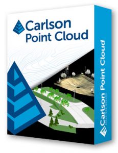
Register your scan to local coordinates, filter or decimate the points, overlay raster images in 3D, snap to edges and code the descriptions for automated field-to finish processing of linework and symbols and create contours, profiles, sections, and breaklines. You will be able to read scan data from many instruments, view and process up to 1 billion points, and then perform the Field-to-Finish from the point cloud data. This Carlson Software office product allows users to export surface models, points, contours, breaklines, grid and profiles to CAD. Read how AeroView Services uses Carlson PointCloud and other Carlson products in their UAV business.
Data Extraction (PC Advanced only)
- 3D extraction of poles, trees, and hydrants
- Extract data from clouds or meshes — TINs, Contours, Profiles, Sections and Breaklines — and draw them in CAD design
Generate Profiles & Sections (PC Advanced only)
- Trace an alignment across the site and generate profiles or cross sections
Create Solids (PC Advanced only)
Create Selection sets (PC Advanced only)
- by color
- by Elevation
Import / Export
- Import/export of grids
- Import/export point clouds containing up to 1 billion points
- Import more cloud formats, including LAS, Leica, Faro (requires installation of conversion software), E57, DEM, GeoTiff, and more
- Export to ASCII, LAS, or PDF (new in 2016)
Multiple Scan Consolidation
- Register multiple scans into one cloud
- Merge clouds
Anomaly Reduction
- Reduce anomalies with Clean Cloud and reduce density with Resample Cloud
Data Improvement Tools
- Continue data improvement with Smooth Mesh and Simplify Mesh (this
reduces the size of the model by removing least significant data points
Field-to-Finish
- Use the full power of Carlson Field-to-Finish with Point Cloud data. You can use the same FLD files you use with GPS or conventional total stations with Symbols, Line Work and Labels all drawn in CAD
Viewing Cloud Data
- Color Adjustment
- View multiple clouds at once
- Color by Elevation or Intensity
- Adjust point size and cloud detail
- View as cross sections
Draw Linework
- Multiple snap modes to extract edges and slopes
Surface Data Commands
- Load Surfaces — Import scan data from various sources
- View Surface — 3D viewer for point cloud data
Scan Utilities
- Re-sample and filter scan data
Breaklines
- Automatic 3D breakline creation based on surface zones
PC Requirements for Point Cloud Perpetual License
| Hardware | Minimum Requirements | Recommended | Most Powerful |
| CPU | G4560 | I7 | I9 |
| RAM | 16 GB | 32 GB | 64 GB or more |
| SSD MVMe | 250 GB free | 1 TB free | 2 TB or more |
Graphics card:
Preferred compatible with OpenGL Version 1.4 or higher:
- Recommended are desktop graphics level discrete (not integrated cards like Intel HD) graphics cards.
- Preferably Nvidia Geforce due to their more consistent driver support.
- Discrete ATI/AMD cards will be adequate, but ATI’s driver support has been spotty and user is frequently deferred to the computer manufacturer for support.
- Professional Nvidia Quadro cards are not currently recommended due to driver issues.
- Powerful gaming cards are not required and probably would not provide as much benefit as investment in more memory or better CPU
