To Buy or not to Buy
Can you make money using a Drone?
That is the question that only you can answer. Perhaps we can help. We offer the following information to help you answer that very popular question.
Consider this: A Drone is simply a means to an end.
What do I mean?
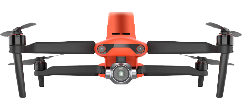
The Drone in and of itself is nothing more than a sophisticated Radio Controlled Aircraft. It does not do anything that will help you with any aspect of Land Surveying work. It is the Payload [CAMERA] on the Drone that is the money maker.
Aerial Photogrammetry is nothing new. What has changed is the technology used to do it has become much smaller, much more affordable and even more accurate.
Use a Drone to transport a high quality Camera with a precision ground Lens and take photos of the ground and features on it.
Now you have a stack of Hi-Resolution images that overlap at the edges. Combine this with Ground Control and RTK positioning on the Drone for best possible precision.
But then what?
In order to transform the 2D photos into a 3D image you need software. And if you want to “stitch” all the images together to create a single image, and transform that into 3D, you will need powerful software.
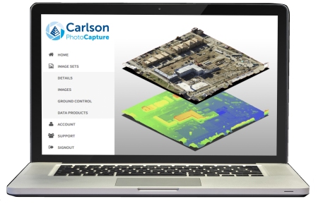
Carlson PhotoCapture is exactly that. Powerful Photo processing software. Available as “Software as a Service (Saas) run on sophisticated servers for a simple and nearly hands-off process, or as a Perpetual License that you can install on your hi-tech P.C. Simply Upload your images, mark your control and Carlson CPC does the rest.
What does that leave you with?
- Orthomosaics in GeoTIFF, jpg, png output format
- DEM in Geotiff, jpg, png output formats
- 3D point cloud in .las, .xyz, and .ply
3D mesh in .ply, .obj, and .glb formats - Contours in .dxf, GeoTIFF formats
- Accuracy Report in PDF format
- In-Browser Volume Calculations
Most Land Surveyors and Civil Engineers will want the 3D Point Cloud as an output but to make a deliverable they will need to put the Point Cloud into software that will allow them to manipulate the data and create a Drawing (*.DWG).
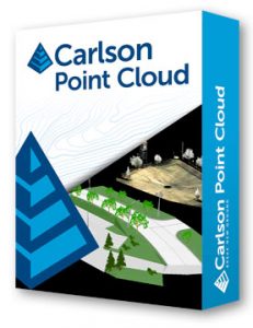
Carlson Point Cloud is your portal to CAD.
Register scans to local coordinates, filter or decimate the points to remove unwanted data, clean to Bare Earth to reduce file size and clarify the data.
Create contours, profiles, sections, and breaklines from within the point cloud and overlay raster images in 3D.
Snap to edges and code descriptions for automated field-to-finish processing of linework and symbols.
Most important: all surface models, points, contours, breaklines, grid and profiles can be exported to your CAD.
Click here to see a short video of the data flow process.
Once in CAD your can add your Survey data and create the necessary deliverable.
What you need to know before buying a Drone
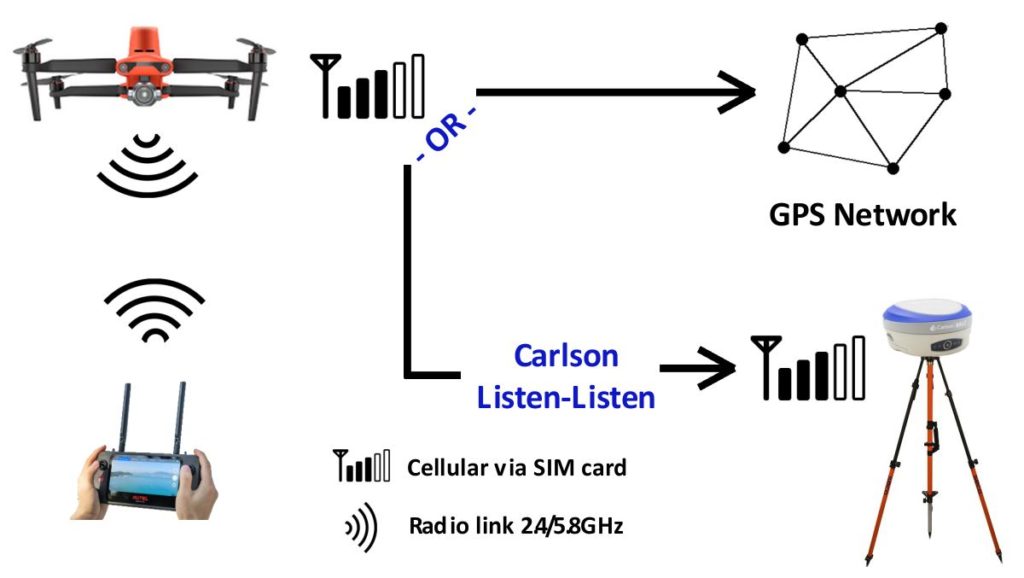
The Carlson EVO II RTK Drone operation requires connectivity to work. The connection between the Drone and the Controller is via 2.4/5.8GHz radio link provided with the Drone. To obtain RTK FIX’d solutions the Drone needs to connect to a correction source: GPS Network -or- Local GPS Base Station. This connection is via Cellular connection to the internet.
When connecting to a local Base Station the Base needs to connect to the internet and I.P. address. This is accomplished with a Cellular Data Plan (SIM card) (not provided with the equipment) and Carlson Listen-Listen service (optional accessory).